Directions for following the Muir Ramble Route
Section Two
Section Two:Henry Coe State Park
Begin: Henry Coe State Park Coe Ranch Headquarters
End: Bell Station
Distance: 26 miles
Trip Description:
Section two of the MRR wanders up and down through Henry W. Coe State Park towards the Pacheco Pass. Coe, a vast wilderness situated just east of Morgan Hill and north of the Pacheco Pass, is the largest State Park in northern California. There are many trails in the park and many routes to choose from. All are equally beautiful. With over 87,000 acres of wild open space you can hike for several weeks without backtracking. The terrain is rugged, varied and beautiful, with lofty ridges and steep canyons. From the park's one-lane dirt ranch roads and small trails you will see California as it was when Muir walked by in 1868: a wilderness of rolling green hills covered with oaks and wildflowers, and ridge tops covered with dry chaparral. The trip ends traveling down the Kaiser Aetna Road to Coes Bell Station parking lot near Highway 152. This part of the trip travels through pastoral rolling hills neatly trimmed by grazing cattle. There are views of Pacheco Pass in the foreground and continually changing panoramic views of the Central Valley and Sierra Nevada to the south and east.
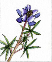
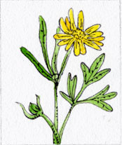
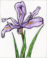
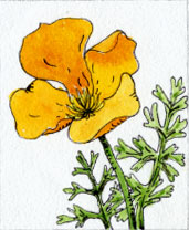
Coe is at its best in the spring when the water is running and the wildflowers are blooming. The wildflowers are amazing, both for the variety and quantity to be seen so plan your trip in the spring. Mountain bikes are allowed on trails in the park but we recommend this as a backpacking trip. Walking, rambling as Muir would call it, is the way to really see and appreciate all the flowers.
Recommended trip:
Begin: Henry Coe State Park Coe Ranch Headquarters
End: Bell Station
Distance: 26 miles
The recommended trip follows the MRR through this section from beginning to end. We suggest taking it as a four-day backpack trip, but it could be done in 3 days by starting early and spending the first night at Coit Lake. Remember backpacking miles can be long and hard (but enjoyable and rewarding) so dont plan to travel as many in a day as you would in a more urban section. One good way to do this trip is with two shuttle cars. First leave one in the small Henry Coe Bell Station Gate parking lot (put a note in the window for the rangers that you are on a backpack trip) then drive to the Park Ranch Headquarters on Dunne Road to start your trip.
We suggest you leave plenty of time to get started and only plan to make day one a half-day. It is a steep 5-mile hike from the Coe Ranch Headquarters trailhead at elevation 2,644 feet to the Los Cruzeros campsite at 1,220 feet. You will have great panoramic views as the MRR follows trails and ranch roads past steep wooded hillsides and vast fields of flowers. There is a swimming hole near the halfway point. Day two is a 7-mile hike that climbs from the creek on a single-track trail then follows the ridge line until it drops down to a campsite at Coit Lake at elevation 2,099 feet. Day three is also a 7-mile hike. First the route stays high, climbing up and down ridge tops, then follows a faint steep trail down to the North Fork Pacheco Creek to a campsite near a nice swimming spot called Hole in the Rock at elevation 833 feet. Day four is a half-day 8.3-mile hike on dirt road that starts with a mile-long 1,600 foot climb and finishes with a 7.3-mile descent to Highway 152. Even though this is more miles than other days it should only take a half-day because it is mostly downhill.
What you need and need to know:
Maps:
Street maps: AAA Sectional Series Central California
Park maps: Henry Coe State Park. This very good topographical map is available at the Headquarters. It can be ordered in advance from the Pine Ridge Association.
Accommodations:
Camping is allowed in Henry Coe State Park
Register:
Before you leave on your hike register at the Park Headquarters. Ask for updates on trail conditions and recommendations for places to camp. If there is no one at the Visitor Center, self-register, pay the fee to park your car (there are parking spaces beside a big barn to the southeast of the Center), leave a note that describes your planned route. If you are shuttling, be sure to let them know your second car is parked at the Bell Station parking lot.
Water:
In spring you will be able to find water in the springs, rivers and lakes on the MRR. It will need to be purified before drinking. In summer and fall the streams and springs may be dry. Check with the ranger before leaving.
Poison oak:
Poison oak arches over many of the smaller trails, so if you don't know what it looks like, ask at the visitor center.
A word of warning:
The terrain is rugged and the weather can be severe, so be prepared! On the first day the trail passes through The Narrows. If it has been raining check to see if this section is passable. If not use an alternate trail to get to Los Cruzeros.
Trailhead Information:
Beginning Trailhead:
Access by Car: Exit Highway 101 on East Dunne Road. Go east for 12 miles, to the end of the road at the Coe Ranch Headquarters.
Access by Public Transportation: Yellow Cab Taxi Co.
Ending Trailhead:
Access by Car: Turn north off Highway 152 (6.9 miles east of the junction of Highway 152 and 156) on the Kaiser Aetna Rd. From the highway the Kaiser Aetna Road looks like a little driveway just to the west of the deserted Bell Station Restaurant. In Muirs day this was a stage stop and so he probably stopped here for provisions.
Access by Public Transportation: Yellow Cab Taxi Co.
Recommended trip trailhead information:
The trailheads are the same.
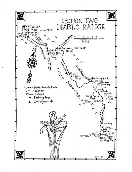
Section Two Directions:
(101.0) Begin by following the Corral Trail, which leaves just across the street from the Coe Ranch Headquarters. Go .6 miles. You will immediately experience the magic of the park as this trail winds in and out of oak forests and wildflower meadows.
(101.6) Just after the intersection with Forest Trail and Springs Trail you will reach Manzanita Point Rd. Once on the road, continue straight ahead, heading southeast. Go .9 miles, down a wide-open rolling hillside, past several walk-in campsites.
(102.5) Turn left on the Poverty Flat Rd. Go 1.6 miles.
Note: Poverty Flat Rd. is shin-splinting steep, but passes some amazingly beautiful giant red-trunk manzanita and hillsides of shooting stars. If you desire a less steep route, follow this alternate route:
Continue .4 miles on Manzanita Point Road.
Turn left on the China Hole Trail. Go 1.1 miles.
Stay right at the junction with Cougar Trail. Go 1.6 miles continuing on the China Hole Trail.
Turn left at China Hole, a nice deep swimming spot on the Middle Fork of the Coyote Creek, that is worth a detour if you want to swim. Go .1 miles up stream to the East Fork of the Coyote Creek to rejoin the MRR at mile 96.6.
(104.1) The road crosses the Middle Fork of the Coyote Creek. Go .1 miles past shaded campsites and a restroom.
(104.2) Just past campsite #5, turn right at a trail sign for China Hole. Go .5 miles, following a creekside trail downstream.
(104.7) Turn left at the first tributary, which is the East Fork Coyote Creek. Go 1.1 miles upstream.
Note: Start following the north bank. The trail will crisscross the creek through The Narrows, passing clear little pools and sculpted rock pinnacles. The river valley will then widen out, with open grasslands on both sides.
(105.8) Continue past a big clearing called Los Cruzeros. Go .2 miles staying on the east side of the creek.
Note: Los Cruzeros is a good half-day hike from the trailhead and a good place to camp. It has three large campsites, and upstream there are a few small holes in the creek to dip in.
(106.0) Cross Poverty Flat Rd. Continue east for a few feet on the trail. At the next trail junction turn right on Willow Ridge Trail. Go 1.6 miles following this steep single-track trail up the hill.
Note: There can be a profusion of flowers on this trail in springtime. In 1.3 miles you will pass No Name Trail on the right. It leads to a trickling water source called Willow Ridge Spring and just beyond that there is a beautiful dry campsite under giant oaks, with a stunning view into Kelly Cabin Canyon.
(107.6) Turn right on Willow Ridge Road. Go 3.5 following the crest of the ridge towards Coit Lake.
Note: There are beautiful views in all directions. If you need to cool off in 1.6 miles there is trail to the left for Hoover Lake. It is not much to look at, but wet, and only ten minutes off the trail.
(111.1) Continue past a road with a trail sign for Coit Dam. Go .6 miles.
(111.7) Coit Road leaves to the left. Willow Ridge Road becomes Crest Trail. Continue straight ahead on Crest Trail. Go 1 mile.
Note: It is a good days hike from Los Cruzeros to Coit Lake. If you want to spend the night at Coit Lake turn left here. Go .3 miles and you will reach the south end of Coit Lake. Follow the road to the left, staying on the west side of the lake, and go .2 miles. You will come to a nice improved campsite with a restroom. If that site is occupied, a faint trail around the southeast end of the lake will take you to the horse camp. It is unimproved but has a metal corral on a flower-garden hillside and great views of the lake. Below the campsite the lake seems inaccessible but we found it wasn't. We just had to slide over 10 feet of reeds to get to the water for a swim!
(112.7) Pass the Kelly Lake Trail on the right. Go .2 miles.
Note: In .1 miles you will reach the highest point of the trip passing by an unnamed peak at an elevation of 2625 feet, with a 360-degree view of the park and beyond.
(112.9) Turn right on Wagon Road and go .8 very steep miles.
(113.7) Turn left at the next trail junction, which is the inappropriately named Center Flats Road. Go 2.4 miles, rising and falling over a series of steep hills.
(116.1) Pass the Walsh Trail on the left. Go .2 miles.
(116.3) Turn left on Scherrer Trail. Go .7 miles descending as the trail following a series of little sloping ridges.
Note: Scherrer Trail is a cutoff to the Kaiser Aetna Road which leads to a swimming spot called Hole in the Rock on the North Fork of the Pacheco Creek. The trail is easy to miss. No signs are posted and only a faint old trail leaves Center Flats Road and heads down the hill. This trail will get so faint you will think you have lost it, but look for a cut in a hillside, or a swath of goldfields through the grass, to show you the way. It is a lightly used trail, a real adventure to follow, but even if you lose it, you can just keep going downhill and you will eventually get to the Kaiser Aetna Rd. If you want to avoid the cross-country hiking, extra miles and 1600 feet of elevation change, follow this alternate route:
Continue on Center Flats Road. Go 1.5 miles.
Turn right on the Hersman Pond Trail. Go .4 miles.
Meet with the MRR at mile 119.7
(117.2) Stay left, and head downhill. Go .3 miles.
Note: The right fork goes up hill to man-made Scherrer Pond.
(117.5) Turn left on the Kaiser Aetna Road. Go .3 miles.
Note: This road is occasionally used by ranchers and they wont be expecting hikers, so be careful of fast moving trucks.
(117.8) Turn left on an unmarked trail that follows the North Fork of the Pacheco Creek upstream. Go .1 mile and you will find Hole in the Rock.
Note: This is a good days hike and a great place to spend a night. There is a big swimming hole, with a little waterfall, and campsites on the grassy bench just upstream of the pool and downstream on the other side of the road.
(117.9) Return to the Kaiser Aetna Road and turn right. Go 1.8 miles, past the Scherrer Trail, and up a steep 20% grade.
(119.7) Pass Hershman Pond Trail on the right. Go .2 miles.
(119.9) Pass Dowdy Ranch on the left. Go .5 miles.
Note: Dowdy Ranch, with water, restrooms, picnic areas, horse corrals and a visitor center, is open seasonally, on weekends and holidays, from 8:00 am to sunset. Vehicle access is allowed on a limited basis. Check with the Henry Coe Park Headquarters Visitor Center for current information. Day use fee is charged.
(120.4) Pass the trail to Burra Burra Peak on the right. The Kaiser Aetna Rd. curves left. Go 6.8 miles down the nicely graded dirt road, winding through pastoral rolling hills, neatly trimmed by cattle grazing, with continually changing panoramic views to the south and east.
Note: If it is a clear day, in the distance to the east you will be able to see the Sierra Nevada, gleaming over the mountain ridges of the Pacheco Pass. Muir was slightly south of here when he described it as the "Range of Light", but this spot is very close both in location and in spirit. The landscape seems mostly unchanged from what Muir described when he walked by in 1868.
(127.2) End at Highway 152.
Note: There is a parking area here, and camping at Casa de Fruta, 6 miles to the west, or by reservation at the Pacheco State Park, 6 miles to the east.
Resources:
Maps:
Pine Ridge Association
Map Request
9100 East Dunne Ave
Morgan Hill, CA 95037
www.coepark.org/map-intro.html
Transportation:
Yellow Cab Taxi Company
17551 Peak Ave.
Morgan Hill, CA 95037
(408) 245-5222
www.yellowcabca.com
Uber or Lyft
Accommodations:
Casa De Fruta
10031 Pacheco Pass Hwy
Hollister, CA 95023
(831) 637-2666
www.casadefruta.com
Pacheco State Park
Park Headquarters
38787 Dinosaur Point Road
Hollister, CA 95023
(209) 826-6283
www.parks.ca.gov/?page_id=560
Organizations:
Henry Coe State Park
Pine Ridge Association
9100 East Dunne Ave.
Morgan Hill, CA 95037
(408) 779-2728
www.coepark.org