Directions for following the Muir Ramble Route
Section Six
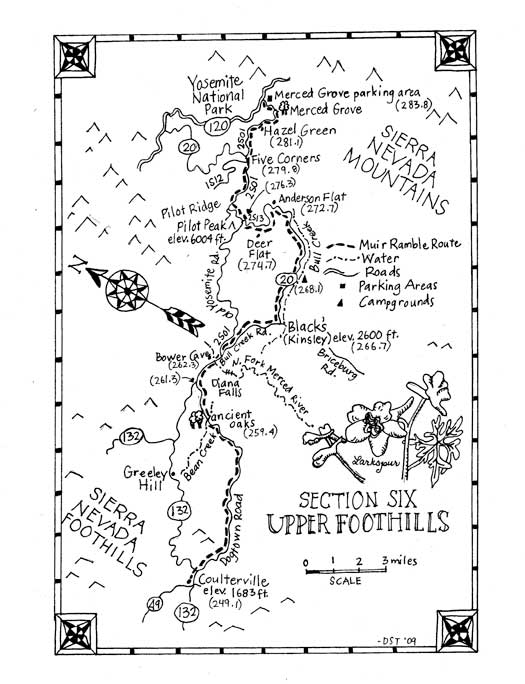
Section Six: The Upper Foothills
Begin: Coulterville
End: Yosemites Merced Grove Trailhead
Distance: approximately 35 miles
Trip Information:
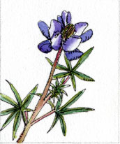
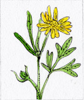
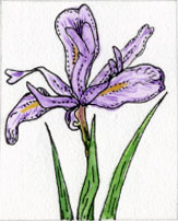
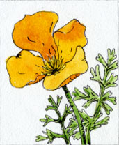
Section six of the MMR follows rural county roads through a lightly populated region of northern Mariposa County, then dirt roads through the Stanislaus National Forest and ends at the northwestern border of Yosemite National Park. The trip begins in Coulterville where old gold rush era buildings line the main street. Out of town the quiet of nature begins to permeate and mans footprint becomes less apparent. Few cars will pass as you wander along the shady canyon along Maxwell Creek and you will find wildflowers, newly leafing oaks and fragrant ceanothus growing at its side. As the route winds up dry chaparral-covered hills the road alternates between asphalt and gravel and at turns reveals expansive views back to the San Joaquin Valley. The dirt forest service road continues to climb and drop through forests eastward towards the North Fork of the Merced River where a side trip to swim in Diana Pool may slow you down a bit. The route then passes Bower Cave, an attraction that used to be so popular that even Muir mentions it. The route begins to climb again as it wanders beside Bull Creek towards Anderson Flat at 3,400 feet. It climbs steeply through thick and fragrant stands of Yerba Santa and buckbrush past Deer Flat and on to Pilot Peak Ridge at 5,400 feet. From there the route passes Hazel Green then crosses the Yosemite Park border where the broadleaf forest gives way to mixed conifers, then the majestic sugar pines that Muir called King of the Forest begin to appear. Section six ends just past the Merced Grove of giant redwoods at the Highway 120 trailhead.
This is not high Sierra wilderness backpacking. We think of it as a backpackers bonus region: a lower elevation trip that can be done when the high Sierra is still buried under snow. The little traveled National Forest Service land of the lower Sierra is also worth getting to know. There are wildflowers, grand vistas and interesting remnants of the regions gold mining past. In fact we find hiking here interesting just because the scenery is so different than it is in the higher granite-filled wilderness where we usually backpack.
Recommended Trip: Begin: Coulterville End: Yosemites Merced Grove Trailhead Distance: approximately 35 miles. The recommended trip encompasses the entire section and can be done either as a 4-day backpack or a 2-3 day mountain bike ride. If you are backpacking the first day is an easy 10-mile walk from Coulterville to an unimproved campsite on Bean Creek, or you can go a bit further to a camp in a nearby ancient black oak grove. Day two is a 9-mile hike to a Forest Service campground on Bull Creek. The third day is a hard 11-mile hike (with 3630 feet elevation gain) to Pilot Peak Ridge at 5,400 feet where you gain vast views in all directions. Day four is a 6-mile hike to the ending trailhead on Highway 120. There is camping at the Crane Flat Campground, which is several miles down the highway but pedestrians will find there is not much of a shoulder on the road. The same itinerary can be followed on a mountain bike or vary it as your skills allow.
What you need and need to know: Street maps: AAA Recreation Series Sierra Nevada - Yosemite Area Park maps: National Forest Map: Stanislaus National Forest, Tom Harrison Maps: Yosemite National Park Accommodations: There are no hotels on the route, but you can camp. Camping is allowed in the National Forest by permit, which is free and can be obtained from the ranger station in Groveland. Please study the camping regulations when you get your permit, and follow the rules while on your trip. Bicycles: Bicycles are allowed on all roads and trails in the National Forest, but are only allowed on roads in Yosemite National Park. The trail from the Merced Grove to Highway 120 is considered a road, so they are allowed there, but the path down to the Merced Grove is considered a trail and they are not allowed there. Water: There is little public water available, but in the spring there will be water in most of the creeks. All stream water will need to be purified before drinking. Remember: Leave No Trace! Warnings: After heavy rainfall, be cautious at river crossings that dont have bridges.
Resources For Section Six: Maps: Stanislaus National Forest 19777 Greenley Rd. Sonora, CA 95370 (209) 532-3671 www.fs.usda.gov/stanislaus/ Tom Harrison Maps (for Yosemite) www.tomharrisonmaps.com Transportation: Yosemite Area Regional Transportation System (YARTS) 1-877-98-YARTS 1-877-989-2787 www.YARTS.com Kowana Valley Lodge 8692 Bull Creek Rd Coulterville, CA 95311 www.optout.vacations/kowana-valley-lodge Contacts: National Forest Ranger Station: Groveland Ranger District 24525 Highway 120 Groveland, CA 95321 (209) 962-7825 www.fs.fed.us/r5/stanislaus Yosemite National Park (209) 372-0200 www.nps.gov/yose/ Visitor Center in the Valley (209) 372-0299 Books: Trails and Tales of Yosemite and the Central Sierra by Sharon Giacomazzi Bored Feet Press, 2004 The Big Oak Flat Road by Irene D. Paden and Margaret E. Schlichtmann Ahwahnee Press: 1955
Section Six Trailhead Information:
Beginning Trailhead: Access by car: Follow State Highway 132 to the intersection with Highway 49 in Coulterville. Note: The Merced Grove trailhead is not a normal trailhead for backpackers, and if you are shuttling you will have to get permission to leave a car there overnight. Get this permit from the wilderness permit station at the park entrance. Leave a note on the dashboard with your wilderness permit number on it. As of May 2007, there are no bear boxes at the trailhead. The closest bear boxes are at the Crane Flat Campground. If the campground is closed you can still find the bear boxes under the snow.
Ending Trailhead: Access by car: The trailhead is a turnout on the right of Highway 120, 4.5 miles east of the Big Oak Flat entrance station. Access by Public Transportation: Yosemite Area Transportation System (YARTS) can be used to get from Yosemite Valley to Crane Flat, but there is no service while the Tioga Road is still closed and only limited service after the Tioga Road opens in the spring. Call YARTS for current routes and schedules. Recommended trip trailhead instructions: Same as above:
Section Six Directions:
(249.1) Leave Coulterville on Main Street (also called Greeley Hill Road and J132) heading east, toward Yosemite. Go .4 miles. (249.5) Turn right on Dogtown Road. Go .2 miles. Note: You will follow Dogtown Road for a total of 11.8 miles. (249.7) Cross Maxwell Creek on a small one-lane bridge. Go 1.1 miles. (250.8) Cross a second bridge. Go 2.5 miles. (253.3) Dogtown becomes a dirt road. Go 2.8 miles. (254.5) Cross the intersection where Schilling Road leaves to the right, and go downhill on the paved road. Go .4 miles. Note: At this junction there is an ATV trail up the hill to the left (north/west). It leads to a small dry camping spot with an almost 360 degree view of the foothills and the Yosemite high country. (254.9) Pass Date Flat Parking Area on the left. Go 1.7 miles. Note: There are restrooms, but no drinking water. This is a place for off-road vehicle riders to park their trailers, and camping is not allowed. (256.6) Pass Wagner Ridge Road on the left. Stay straight on Dogtown Road. Go .6 miles. (257.2) At intersection of Hotzl Road and Dogtown, go right on Dogtown Road. Go .8 mile. (258.) At intersection of Mohawk Road on the left, Bondurant Mine Road on the right, stay straight on Dogtown Road. Go 1 mile. (259.) Stay right to continue on Dogtown Road. Go .3 mile. Note: There is a campsite on the side of the road just before Bean Creek. In season it is filled with blooming wild azaleas. .2 miles further up the road the 2S44 leaves to the left. .1 miles up the hill you will find a dry campsite in a grove of giant black oaks. (259.6) At the next junction, where the 2S45 (Red Cloud Dr.) goes off to the left, stay right to continue on Dogtown Road. Go .6 mile. (259.9) Cross Bean Creek. Go right on Dogtown. Go 1.4 miles. Note: There is no bridge and this can be a deep crossing. In the spring of a very dry winter the water was about a foot deep. When we walked through after a very wet winter the water was raging, so plan accordingly! (261.3) Turn right on Greeley Hill Road. Go .5 miles. Note: Even though this is a main road, it is infrequently traveled and pleasant to walk. (261.8) Pass Buck Meadows Road on the left, Greeley Hill Road becomes Bull Creek Road (also called NF 20, Briceburg Rd. or N2S05!) Go .4 miles. (262.2) Cross the North Fork of the Merced River. Go .1 miles. Note: The Diana Pool and unimproved campsites are about a mile to the southwest. The trail/road leaves on the right, just before crossing the bridge. Go 1.2 miles to reach the campsites, and just beyond are the swimming holes and waterfalls. In 1856 a 20 mile wagon road was built by miners from Coulterville to Blacks Station. It passed the pools, crossed the Merced and followed Bull Creek up to Blacks. Remnants of that trail can still be found upstream of the pools hidden in the dense, almost impassable underbrush along Bull Creek. (262.3) Pass a historical marker and Bower Cave on the left. Go .2 miles. Note: The historic marker describes the Coulterville-Yosemite Road, which leaves ahead to the left as the 2S01. Completed in 1874, it was the first stage road into the Yosemite Valley. At that time was called the Coulterville Road, but now it is known as the Old Yosemite Road. Behind the marker is the trail to Bower Cave. In the late 1800s the cave was a local hot spot, with lively socials. Today it is only the home for swallows, bats and poison oak, but remnants of a dance floor and musicians platform can still be seen. The cave has religious significance for the local Me-Wuk Native Americans. In respect, and perhaps for other reasons, access to the cave is limited, and a permit obtained from the Groveland Ranger District is required to visit it. (262.5) Stay right at the next "Y" junction and the road becomes dirt. Go 4.2 miles, continuing on NF 20, passing a big meadow signed Kowana Valley on the right. Note: Muir certainly would have stopped at Kowana Valley. In his day Blacks stage stop was located here. With pasture for horses, a saloon and overnight lodging in the loft, it was highly recommended in travel books of the 1860s. The actual structure still exists at the east edge of the meadow, a red wooden and rock building next to the modern house. The folks who live there operate the Kowana Valley Lodge. (266.7) Turn left on Anderson Valley Road (also called the NF 20 and 2S02). Go 1.4 miles, going along on the north side of the creek. Note: In 1856 George Coulter and L. H. Bunnell joined together to construct a horse trail from Blacks to Yosemite. Called the Coulterville Free Trail, it followed Bull Creek to Anderson Flat, and then passed through Deer Flat, Hazel Green, Crane Flat and Tamarack Flat to Yosemite Valley. In 1868 this was the main northern route to Yosemite, and Muirs description of his route makes it clear he followed the Coulterville Free Trail. Traces of the trails rock retaining walls can still be found between the NF 20 and the creek. (268.1) Pass a National Forest campground on the right. Go 3.8 miles. Note: The campground has an outhouse and you can get water from Bull Creek, but will need to purify it. (271.9) Pass a turnout on the right, just before the road leaves the creek. Go .4 mile. Note: Down the hill from the turnout are some nice swimming holes. Follow a bare granite ridge over and through the brush and poison oak down to the creek. (272.3) Cross a gate and cattle guard. Go .2 mile. (272.5) Turn left on the 2S13, the next road junction. Go .2 mile. Note: If you stay right on the NF 20 in .1 miles you will reach Anderson Valley (also known as Anderson Flat, the names are used interchangeably on maps and signs). There is a camping area with an outhouse. You can filter water from Bull Creek, which meanders through the valley, and in a dry year this may be your last source of water for the next 10 or 15 miles. (272.7) Pass a gate. Go 1.8 miles. Note: This is often closed to block vehicle access, especially when the roads above are muddy, but hiking is allowed even when the gates are closed. (273.9) Pass 2S13F on the left. Go .7 mile. (274.6) Pass 2S13C on the left. Go 1 mile. (275.6) Pass 2S97 on the right. Note: Deer Flat, where Muir said the wagon road ended in a trail, is west of here. Pass a well-maintained gravel road on the right. Go .7 mile. Note: There is a spring .6 miles down this road. The next water is over 5 miles away, at Hazel Green. This could be a good place to spend the night and fill your water containers for the next day's hike. (276.3) Pass a seasonally closed gate. In a few yards turn right on the unsigned Old Yosemite Road (the 2S01). Go 1.3 miles. (277.6) Pass the 2S04 to the left at the top of the ridge. Go .5 mile. Note: Side trip: Pilot Peak. The 2S04 leads to the Pilot Peak fire lookout. It is usually closed to vehicles. The views are worth the 2.8-mile round-trip walk. To the southwest, in the distance you can see the meadow at Blacks and closer to Pilot Peak you can see both Anderson and Deer Flats. In the distance to the east, the snowy peaks of Yosemite form a jagged silhouette. There is a nice flat campsite here, but no restrooms or water. (278.1) Pass the 2S25 on the left. Go 1.7 miles. (279.8) At a major junction, known as Five Corners, take the third left, which may be unmarked, but according to maps is still the 2S01. Go .6 mile. (280.4) Pass an unmarked dirt road on the left. Continue on the 2SO2 for .5 mile. (280.9) Pass a main dirt road to the left (this is the 1S11 and leads to Highway 120.) Go .1 mile. (281.) Pass an unmarked road to the right. Go .1 mile. (281.1) Continue straight through a gate with "No Trespassing" signs. Go .3 miles. Note: Hazel Green is private property. You will be trespassing if you go off the road but the National Forest retains a right-of-way to use the road. In .2 mile, on the left, there is a black plastic spring box. The caretakers at Hazel Green gave us permission to fill our water bottles there, so if you ask, you probably can probably get water there too. If it is a wet year, water can also be found ahead in a little creek near the Merced Grove trail, but if not, this is your last water source for 8 miles until you get to the Crane Flat Lookout (and Crane Flat only has non-potable water that will need to be filtered). (281.4) Pass Hazel Green's old buildings on the left and a newer log barn on the right. Go .3 mile. (281.7) Pass through a barbed wire gate marking a boundary to a finger of Yosemite National Park. Go 1 mile. (282.7) Stay left at the fork in the road where the 2S23Y goes right. Go .2 mile. Note: There are some flat spots here where you can camp while still in the National Forest. Once in Yosemite no camping is allowed on the Ramble Route until you reach Crane Flat Campground, near mile 289. (282.9) Pass a sign for the Yosemite National Park boundary on the right. Climb over a locked gate. Go .3 mile. (283.2) Pass the trail to the Merced Grove on the right. Go .6 miles. Note: It is 1 mile, down a steep trail to the Merced Grove. This infrequently visited grove of about twenty giant sequoias is quite peaceful. Their reddish, deeply fissured bark creates a beautiful contrast of colors with the surrounding forests green foliage. This grove had not been discovered by European settlers when Muir walked through, his road went almost directly from Hazel Green to Crane Flat. When the grove was found in 1871, the Coulterville Road was diverted to the south and east to give travelers a chance to visit the grove. (283.8) End at the Merced Grove Trailhead parking area on Highway 120.